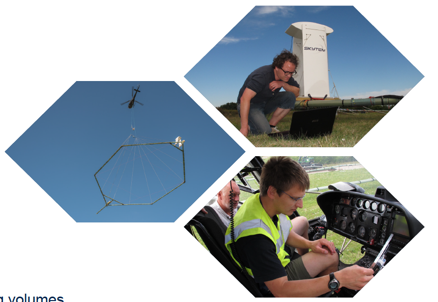
The SkyTEM, helicopter-borne geophysical scanning system will be operating in and around Fresno County next week. SkyTEM image
Written by
Starting next week residents living west and south of Fresno may see something strange in the air that is part of an effort to map groundwater aquifers.
Stanford University is working with a company called Aqua Geo Frameworks LLC that uses low-flying helicopters towing a large hexagonal frame that is used to map geologic structures and groundwater resources down to about 900 feet below the land’s surface.
Beginning around Nov. 23, residents of communities including Fowler, Kingsburg, Lemon Cove, Orange Cove, Orosi, Parlier, Piedra, Reedley Sanger, Selma and Woodlake may see the helicopter with its scientific equipment that hangs about 100 feet below the helicopter in a spider web array.
The helicopter will be flown by pilots who are specially trained for low-level flying and their flight path is designed to get the best available underground data. The helicopters are flown by Sinton Helicopters out of Paso Robles.
Since data can only be collected over open spaces, no data collection will occur over residential areas, livestock feeding operations or other buildings. After the flights, Stanford University will use the data to develop an improved understanding of recharge in the area.
The Stanford study is being funded by a $1.31 million grant from the Gordon and Betty Moore Foundation.
Related Posts
-
 Family Owned Business Awards: Meet the honorees, part 3 Posted: July 2, 2025 at 2:31 pm
Editor’s note: On Friday, June 20, The Business Journal revealed
Read more » -
 US stocks hit another record as Tesla and Nike rally Posted: at 2:29 pm
U.S. stocks ticked higher to hit another record. The S&P
Read more » -
 The Latest: The House returns in a rush to pass Trump’s bill Posted: at 2:29 pm
Republican leaders in the House are sprinting toward a Wednesday
Read more » -
 RSV vaccine access expanded to some people in their 50s, according to CDC website Posted: at 2:28 pm
The Trump administration appears to be expanding RSV vaccinations to
Read more »
Central Valley Biz Blogs
-

BLOG: SB 7 puts automation on trial, could stall workplace innovation
Posted: June 30, 2025 at 2:42 pm
The California Chamber of Commerce has identified Senate Bill 7
Read more » -

BLOG: Using fallowed ag land for solar farms opens training, job opportunities for local workers
Posted: at 2:00 pm
In all the talk about the San Joaquin Valley’s groundwater
Read more »